Maps of the Czech republic and the EU
Useful map tools for better orientation in the issue of the location of green technologies in landscape, environment.
A LIST OF USEFUL LINKS
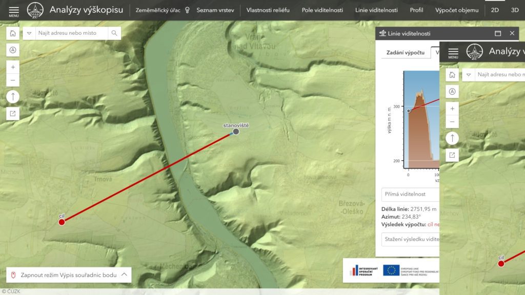
- publisher: land survey office of the CZECH republic
- purpose: obtain an overview of the relief of the landscape (where there are hills, valleys)
- usage: assessment of the impact of landscape character
- tools: measurement of the direct visibility of the adjustable height observations over the terrain
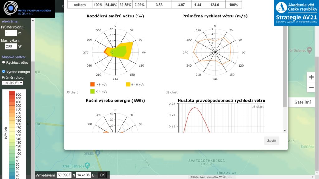
- publisher: Institute of atmospheric physics, Czech academy of sciences
- purpose: mapping of wind conditions at a specific coordinate (it Pays to operate a wind turbine? What are prevailing winds?)
- usage: findings the frequency of the intensity of the force of the wind, depending on the direction of the wind for a specific location
- tools: the calculation of the energy produced at 10 meters above the surface for 200W and a 5kW turbine rotor
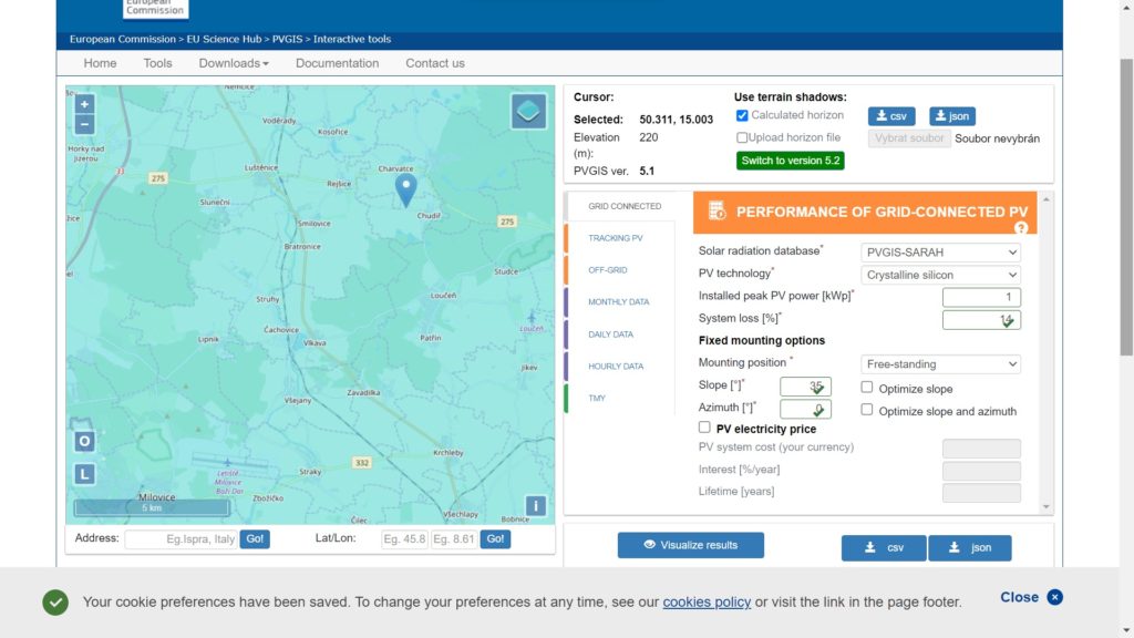
- publisher: European commission
- purpose: annual, daily and hourly statistics of the production of photovoltaic panels to a specific location.
- usage: determining the conditions for the operation of a PV power plant in the specific setting of the power plant including the slope, type and application system panels
- tools: for variants on / off grid (delivery to the network / island system), systems of monitoring the position of the Sun. temperature, relative humidity, wind direction and speed, atmospheric pressure
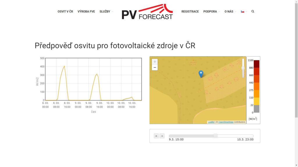
- publisher: UCEEB CTU
- purpose: daily weather exposure for a specific location
- usage: determine what the potential has the Sun for the day (publicly available data)
- tools: timing chart of light exposure during the day (W/m2)
- instructions: click on the map to display the graph for a specific coordinate
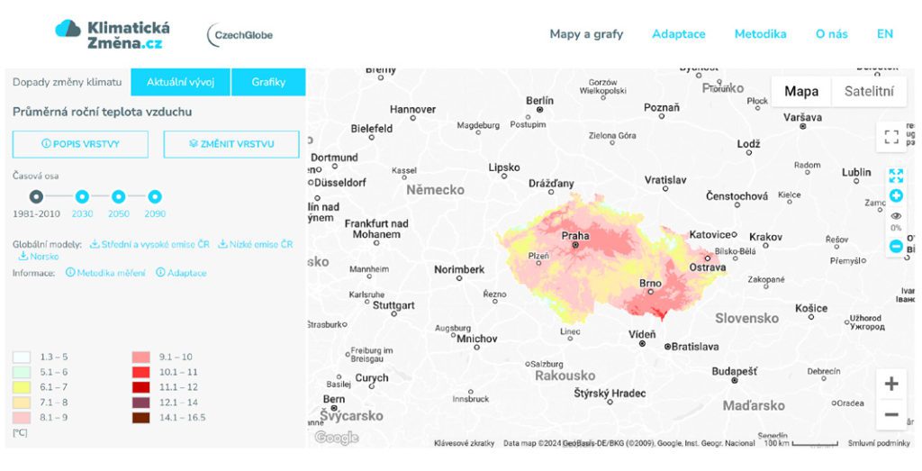
- publisher: Department of global change research of the ascr, v. v. i.
- purpose: a preview of the future climate development
- usage: determine what the potential has the Sun for the day (publicly available data)
- tools: layers showing the temperature extremes, water balance, vegetation season, the development of agricultural production...

- publisher: Česká Geologická Služba
- purpose: tepelný potenciál pro souřadnice v rámci ČR, včetně výsledků měření z vrtů
- usage: Jaká je teplota v pěti kilometrech pod povrchem naší republiky? Mapa na toto odpovídá. Slouží hlavně pro samosprávné celky a státní organizace, které zvažují využití geotermální energie pro vytápění a výrobu elektrické energie.
- tools: teploty v hloubce 5 kilometrů, omezení a střety zájmů.
- purpose: sluneční kalkulačka
- usage: získání představy, jaká je orientace Slunce v konkrétní čas
- tools: zadání přesných zeměpisných souřadnic
